Natalie Robbins
 Natalie Robbins, originally from Arizona, had dreams of becoming a park ranger. However,
when she found a hiring freeze had been put on government jobs, Robbins had to pivot
to create a new plan for her career. While an undergraduate in Arizona, she heard
a little about geographic information systems (GIS) but had not yet had the chance
to learn the computer systems used for studying data related to positions on the Earth’s
surface.
Natalie Robbins, originally from Arizona, had dreams of becoming a park ranger. However,
when she found a hiring freeze had been put on government jobs, Robbins had to pivot
to create a new plan for her career. While an undergraduate in Arizona, she heard
a little about geographic information systems (GIS) but had not yet had the chance
to learn the computer systems used for studying data related to positions on the Earth’s
surface.
“Searching for jobs, I quickly discovered that GIS skills were highly desirable and something I didn’t have,” Robbins said. “With all of that information, I started looking at grad school programs that focused on environmental science but also integrated GIS, and I ended up finding the professional science master’s program at Tennessee Tech.”
Tech’s program with a concentration in environmental informatics focuses on GIS while also integrating courses in business and statistics. Along with these courses in spatial analysis, students develop skills in remote sensing, policy analysis and environmental management.
“One thing about the professional science master’s program that I don’t think is highlighted enough is how much everyone in the program cares about making sure you succeed,” Robbins said. “I never felt like I was on my own or had to just figure it out, even post-graduation. Everyone in the program is invested in making sure the graduates are able to find a job in their wheelhouse and the program has created a great network of post-grads looking to help each other succeed, as well.”
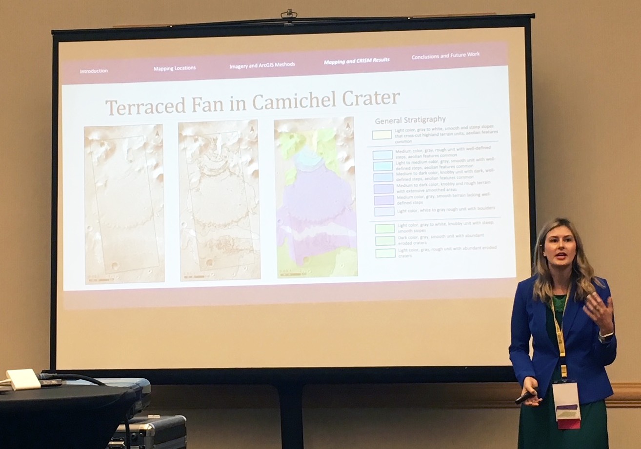
While at Tech, Robbins was given the opportunity to work on a NASA-funded project involving the mapping of geography on Mars. She was the GIS go-to for the project and helped develop workflows for planetary geologic mapping. She presented her work at both the Geologic Society of America and Tennessee Geographic Information Council annual meetings.
“The various GIS classes I took, especially Environmental Applications of GIS, have been crucial for me in my role,” Robbins said. “What I really appreciated about that class is that it gave us experience using real GIS data, which is messy and requires cleaning before you can use it for analysis. That prepared me for the types of data cleaning and joining tasks I would be doing quite often.”
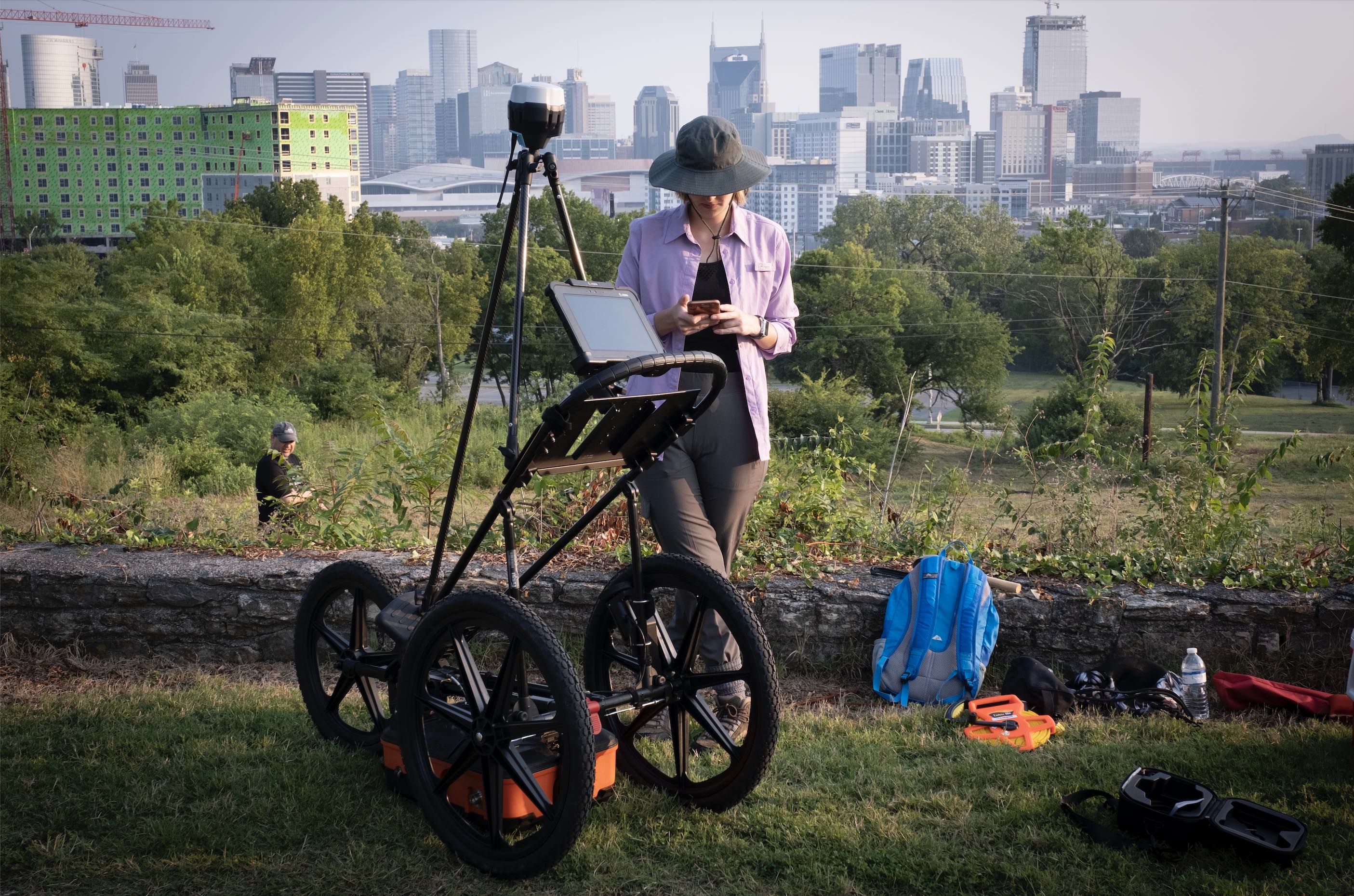
Now a graduate of the program, Robbins works as a geospatial consultant for researchers and collaborators across the United States as the program manager at the Vanderbilt Institute for Spatial Research. In that role she is also helping to conduct geophysical investigation herself. She is a member of a team using ground penetrating radar to map the Battle of Nashville Civil War sites. She has also worked on a project unearthing the identities and stories of enslaved, indentured and free people of color on the east end of Long Island, New York, from the 17th-19th century.
“If you are coming in to the program with one goal, allow yourself to move towards that goal, but don’t let opportunities slip away if they may not be 100 percent in line with that goal,” Robbins said. “I came in to the program wanting to be an environmental consultant and wanted to complete my internship with a company like that. The opportunity to work with Dr. Jeannette Luna (chair and associate professor of earth sciences at Tech) came along and I am so grateful I pursued that. It led to amazing conference and presentation opportunities and affirmed my love of research to help get me to the career I am in today.”